Over the 4th of July weekend this year I lucked into a last-minute overnight permit for the Shadow Creek trailhead at Ansel Adams Wilderness, in the Eastern Sierra Nevada, California. I decided to see how close I could make it in single day up towards the rugged peaks of the Minarets, a classic Sierra climbers’ playground with extreme ridgelines and glaciated alpine lakes.
From the Bay Area, AAW may be reached by a roundabout trip through South Lake Tahoe, a direct route through Yosemite National Park (Tioga Pass 120), or a much-less traveled road called the Sonora Highway (108) through Emigrant Wilderness and the picturesque Sonora Pass. Opting for the latter, I reached the Eastern Sierra in the picturesque town of Bridgeport, where the Independence Day rodeo was gearing up to start.
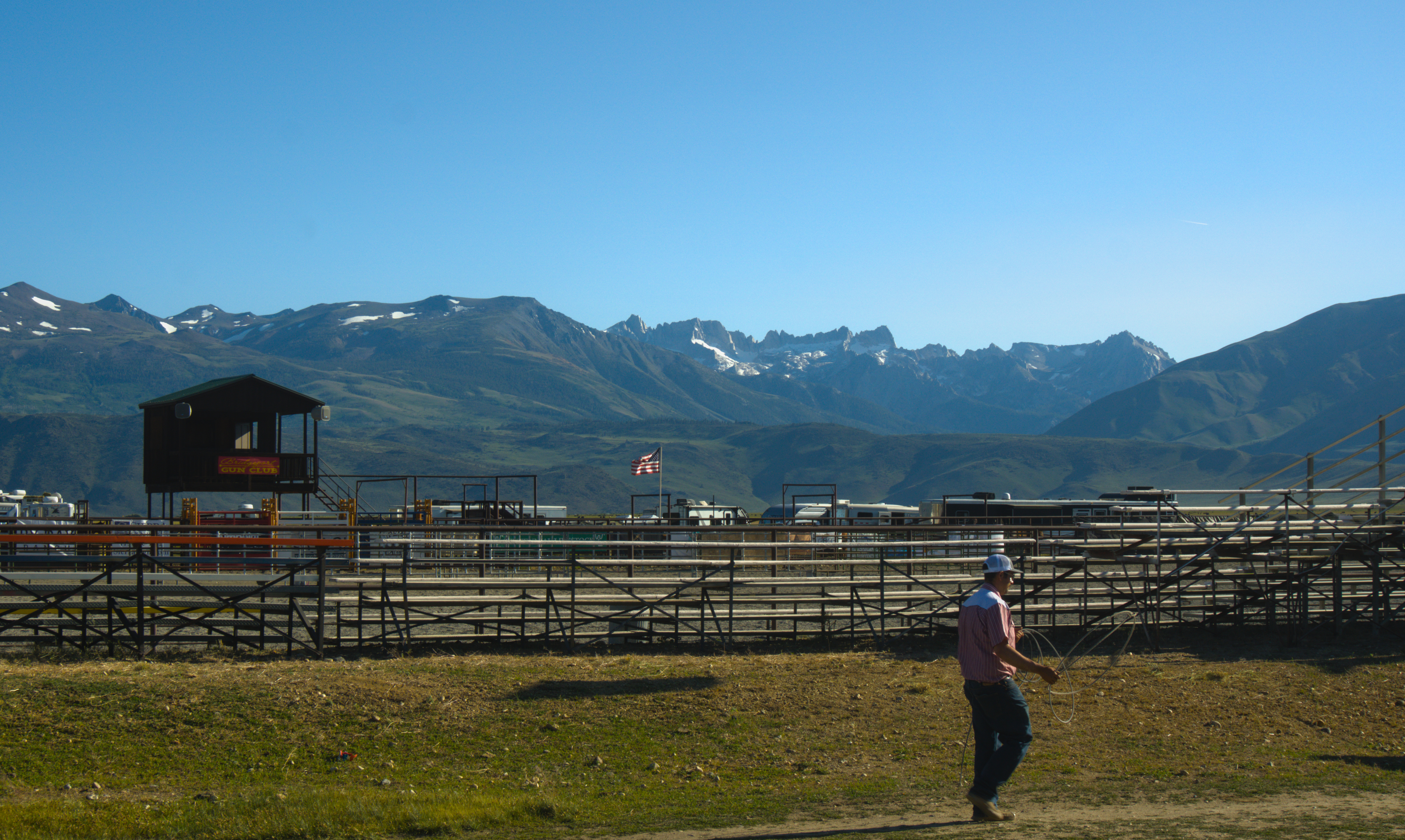 The Yosemite/Hoover mountain ridgeline visible from Bridgeport, CA
As I pulled through town I took in the sight of cowboys grilling, hitching their horses, and practicing lasso work as I admired the view of mountains. Right from highway in Bridgeport you can catch seee the high peaks of Hoover Wilderness which form the northern border of Yosemite. The toothsome ridge points are called by names like Eocene, Blacksmith, The Doodad, The Dragtooth, Sawblade, and Matterhorn Peak (12,281 ft), the highest in the range. A small glacier adorns the crest. Not far to the west of Bridgeport, the Marine Corps is dug in at their Mountain Warfare Training Center, with private airfields and miles of fire road.
About an hour south on Highway 395 to Lee Vining, alien-looking Mono Lake, and then to Mammoth Lakes, a resort town for skiers of Mammoth Mountain. I stayed overnight at a hotel attached to the ski resort, offering via ferrata and horseback riding in the summer. The trailhead requires use of the resort’s private road (mostly for visitors to Devil Postpile national monument, a columnar basalt cliff). The road itself is closed to private vehicles during the day - I thought I’d slip through before operating hours, only to be told they had changed their hours, and I’d have to turn back and take the bus. I lost about an hour backtracking, and squeezing onto the glacially slow, standing-room-only bus crammed against the bus door with ice axe and helmet clacking against the glass (for $15 roundtrip). I disembarked the stop about a quarter mile from the trailhead where more practiced hikers had parked.
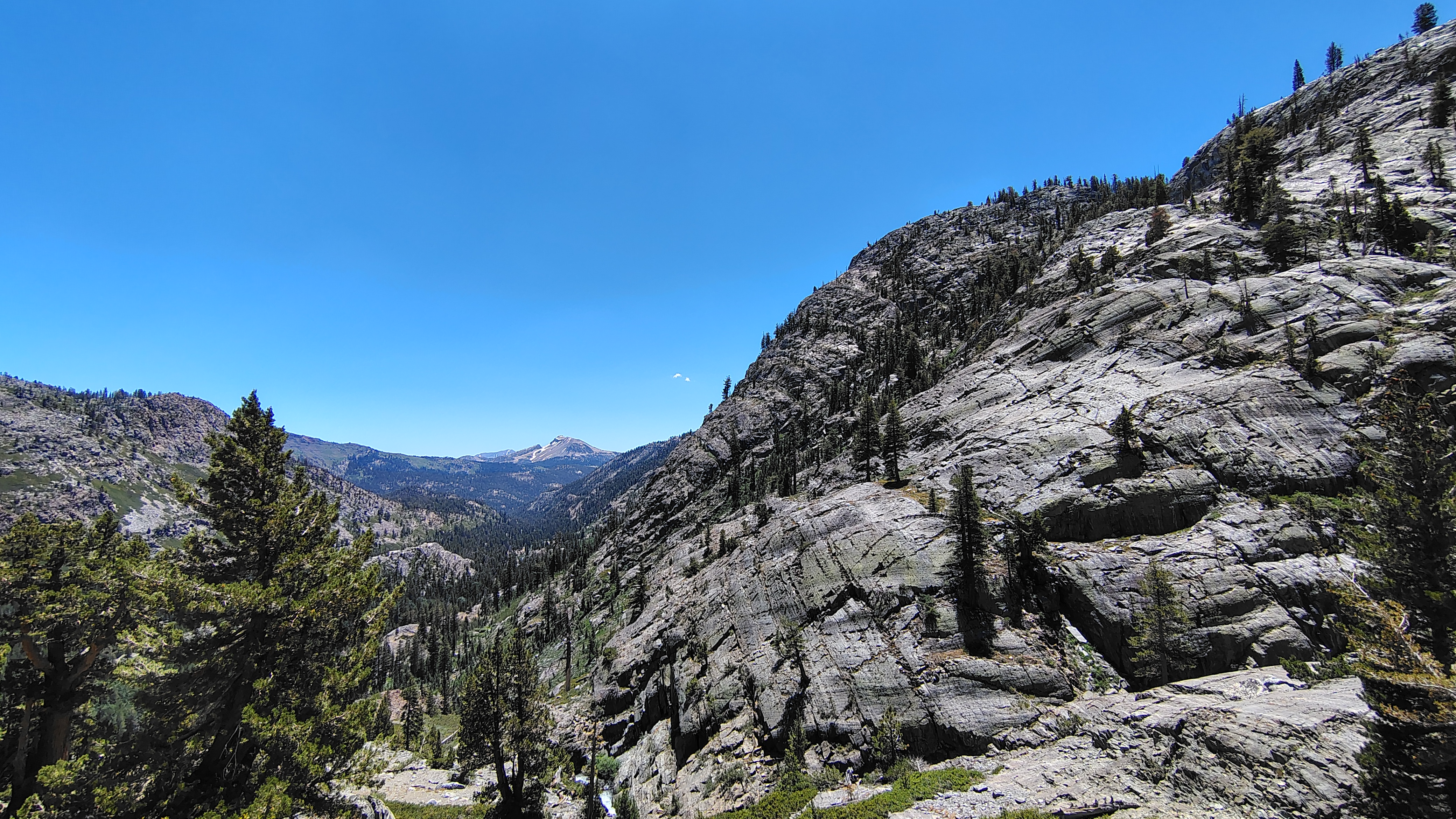 The hike properly starts with a climb from the valley up some rocky switchbacks.
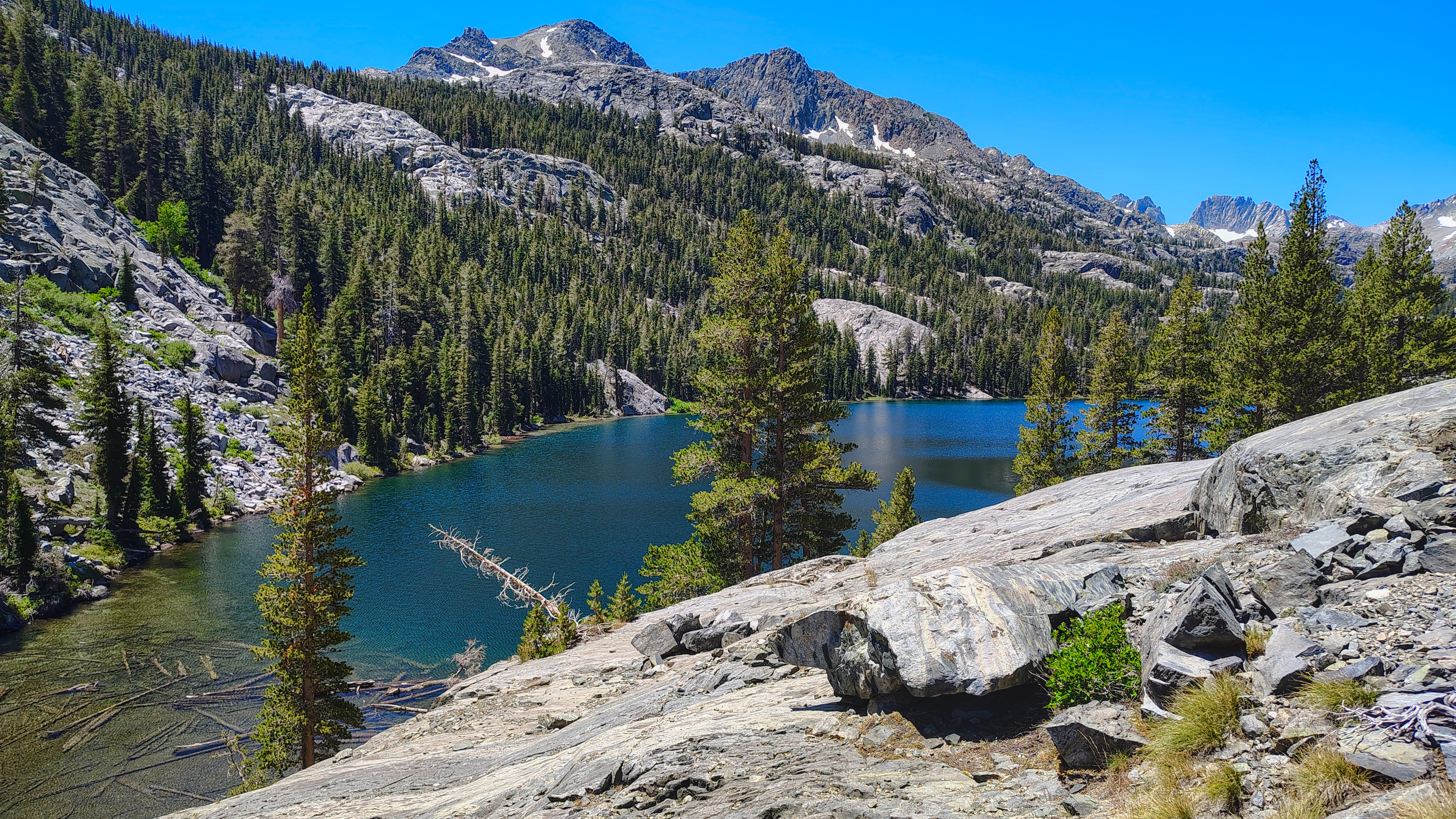 Shadow lake looks impossibly blue, attracting thru hikers and trail runners.
The trail begins with about 3 miles of gentle descent and flat trail along the valley floor, then crosses the creek and begins a 1000ft climb up exposed switchbacks over rolling granite blocks. The forecast called for highs of 80, but even at 8000' the July heat was opressive without any shade to shelter. At the top of the hill, one encounters Shadow Lake, a glimmering blue oasis with trees on all sides and impressive views of Mt. Ritter and Banner Peak, the highest points of the Minaret subrange.
My rest at the lakeside was short-lived, as mosquitoes surrounded me the moment I stopped anywhere on the trail. The “natural” repellent I’d brought did more to irritate my eyes than repel insects, so I opted instead to keep moving as much as possible. The trail continues about 4 miles further up mostly flat terrain to another granite headwall protecting Ediza Lake, the absolute jewel of the valley, said to be John Muir’s favorite lake in the Sierra.
 Ediza Lake is possibly most picturesque body of water in California
 Mt. Ritter and Banner peak share a saddle high above Lake Ediza. The regular route climbs the high colouir between the peaks.
Camping is prohibited along most of Ediza’s shores, but its western reach at the foot of Mt. Ritter is used as a base camp for summitting the peak, or sometimes by hikers along the Sierra High Route, a 195 mile cross-country route for more adventurous through-hikers wanting a challenge at higher elevation than the John Muir Trail.
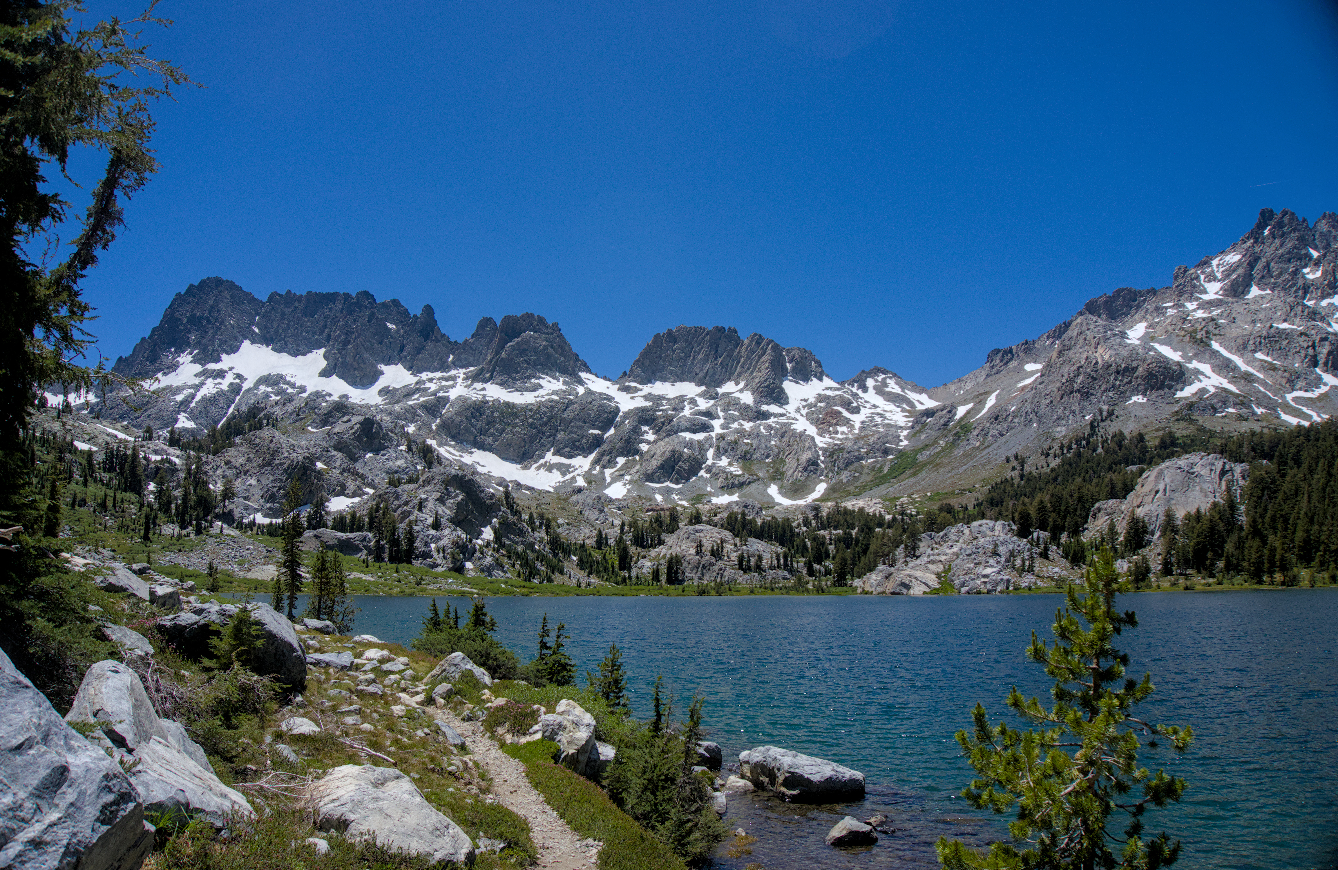
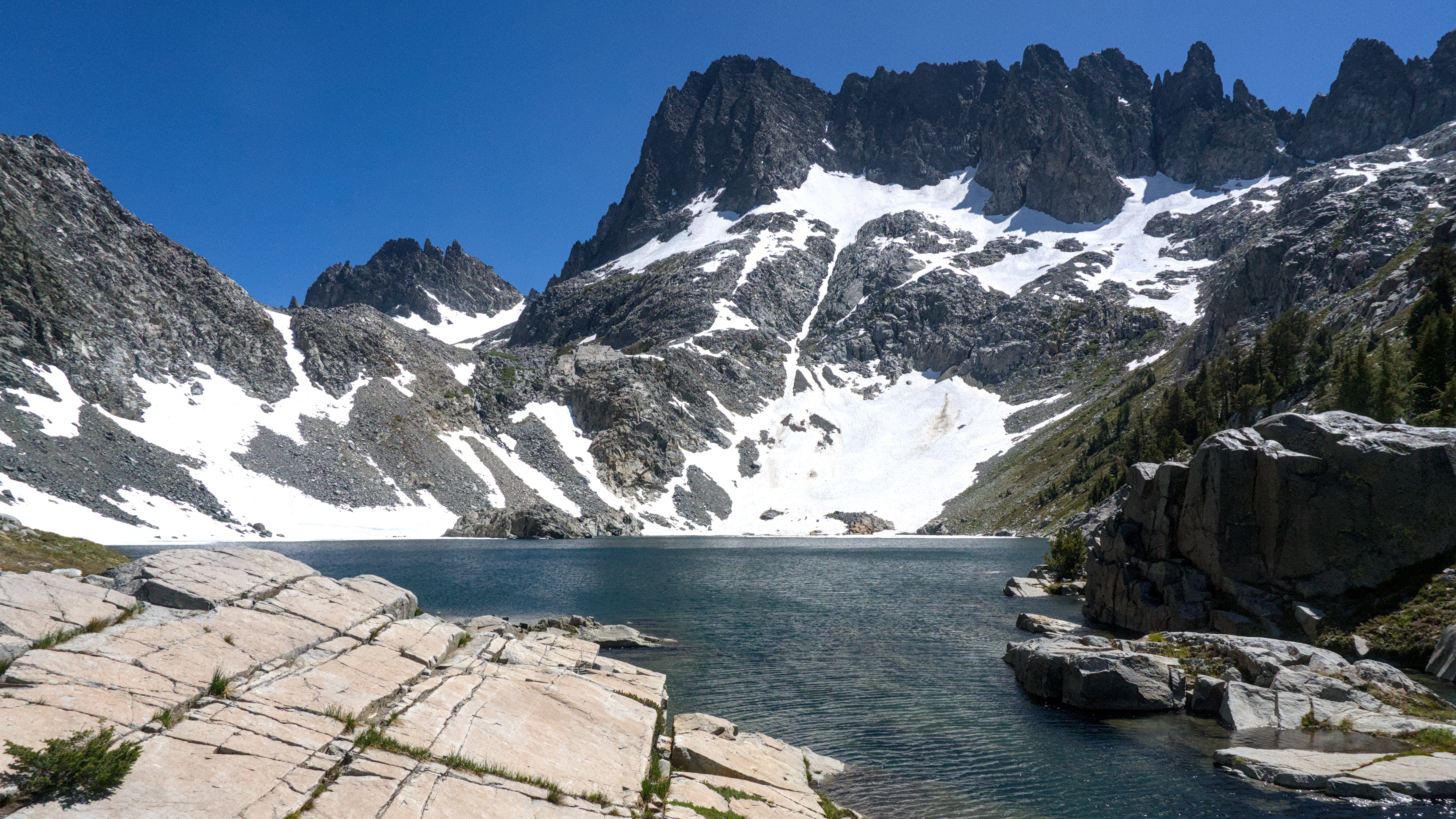 Clyde Minaret dominates the ridge above Iceberg Lake. The traverse to Lake Cecile runs across the slope on the far shore, and the South Notch from which Clyde can be climbed is just visible behind its left slope.
The trail then begins a steep climb up about 600’ of trail, talus, snow, and washed out streams toward Iceberg lake, with some shade offered by the unnamed “Volcanic Peak” above it. After some scrambling, the trail emerges into a picturesque grassy alpine valley with stunning views of Clyde Minaret, the oft-climbed classic crag that forms the apex of the range. A little further on one glimpses the shores of Iceberg Lake, and its great granite island that gives it its name in wintertime.
The eastern shore of the lake is a sheltered meadow where I planned to camp. Around 4:00 I set up my camp in a clear patch protected by boulders rom the wind and re-equipped to take a strike at my high objective. I was already running late from the morning's delays and moving quite slow from the very hot conditions, so I set my turnaround time for 5:30 and headed out, giving me a little over an hour to climb.
 The castle walls above the lake become more impressive the nearer you approach
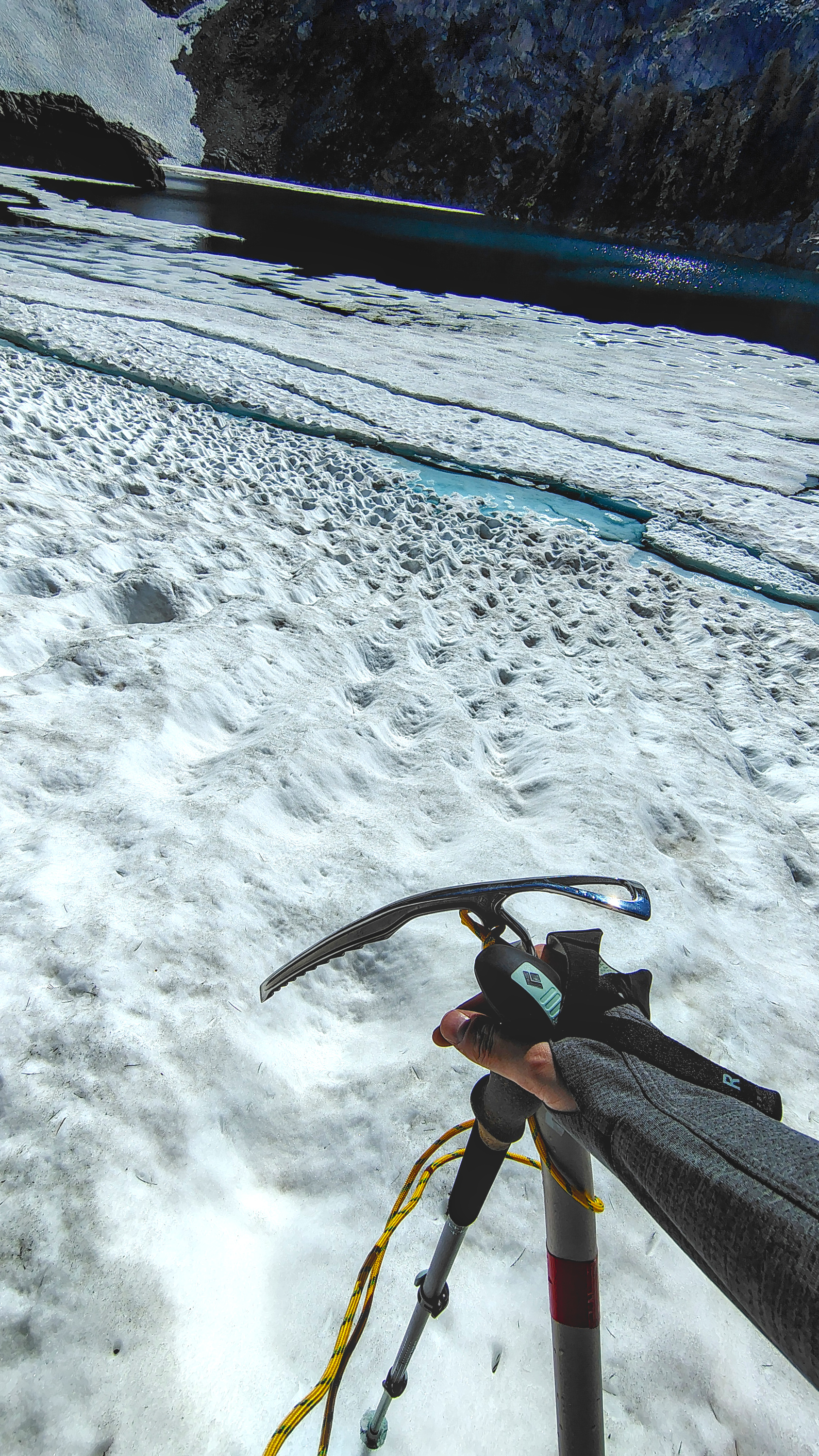 Terrain below the traverse consists of steep snow and cracked up glacier tongue
Past the meadow, the trail winds over the edge of a cliff above the lake, then disappears into a traverse across a half-mile of boulder fields. Part of the trail ran beneath snowed-over sections yet to melt. I scrambled to the first snow sections where I put on some spikes and brandished the ice axe. The snow had turned very soft and slushy, but the sun cups and occassional boot tracks offered more secure footing.
I took to plunge stepping with my heels to dig in. Three or four snow crossings were required. The boulders are loose and chaotically strewn, but the snowy slope runs directly down to the icy lake shore, which has no climbable beach nearby, making it an unassuming but potentially very dangerous place to fall.
 Looking north towards Mt. Ritter from the traverse. The path is exposed to rockfall from above and a slippery runout into icy water below.
All this combined to make the route more technical than I expected, and I moved very slowly. As I crossed the 10,000ft elevation line, I did some quick mental math, and realized I would likely reach Lake Cecile at about 6:15pm. I only had roughly 300 vertical feet left to ascend but I was still baking in the sun, moving very slowly, and I really didn't relish the thought of descending the snow and talus in darkness, so I elected to skip the final push up to the next lake and turned back toward camp at about 5:45.
From the high point I was rewarded with views of Ken and Kehrlein Minarets, as well as the snow-covered eastern gully called the Soutch Notch I’d eyed on the map as a possible non-technical route up to the ridge. It seemed a million miles away at the time, but was only about 1 mile and 1300’ of elevation away, mostly off-trail scrambling and straight snow-slope climb.
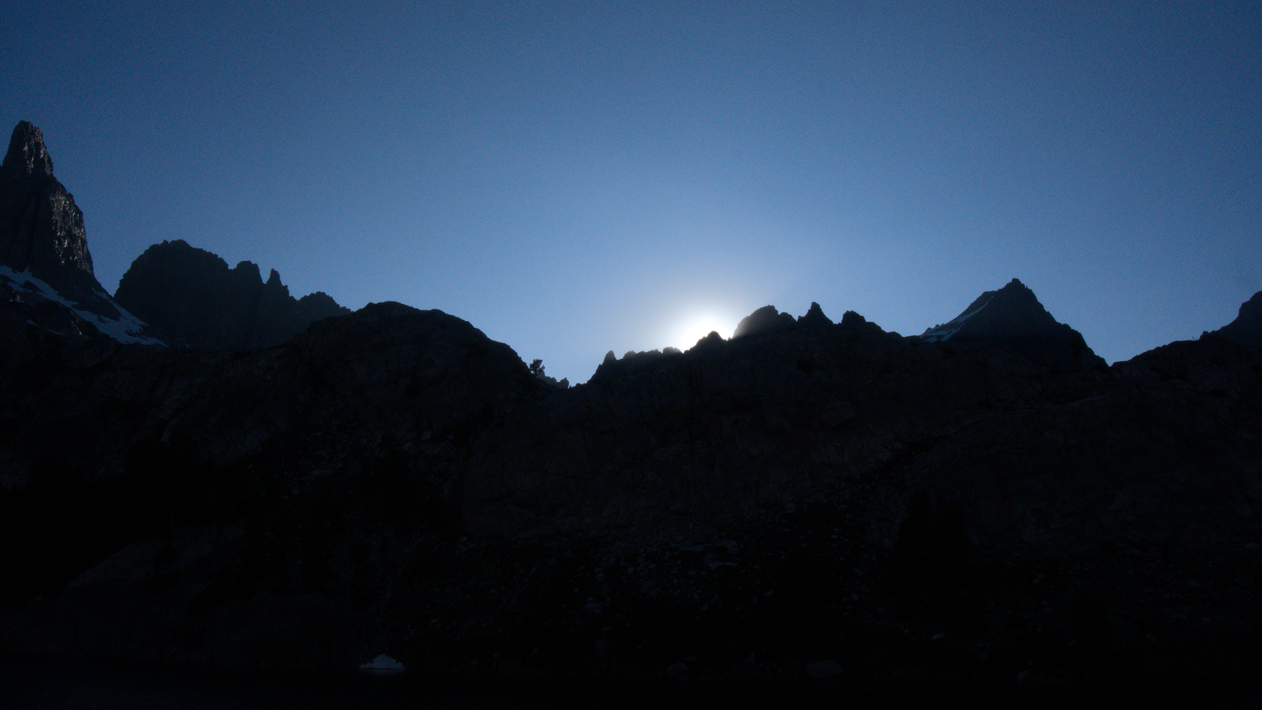 Sunset on the Minaret Ridge bathes the valley in shadow
On the return trip I passed an intrepid climber who was also a little surprised by the technical nature of the traverse, but was more determined to make it up the next lake. I advised him on the trail location and watched him cross the slope about twice as quickly as I had, despite lacking an axe or crampons. When I reached the lakeside meadow, I met some backpackers who had made the same attempted traverse as and also elected to turn around.
While I was a little disappointed not to attain the high lake, much less the mountain ridge, the feeling was overshadowed by awe at the sunset silhouette of Minaret Ridge. The granite castles above the glacier resemble the peaks of Tierra del Fuego or the Alps more than most California peaks, and their remote, almost hidden location gives them an austere, wild majesty unlike their more famous neighbors in the nearby National Parks.
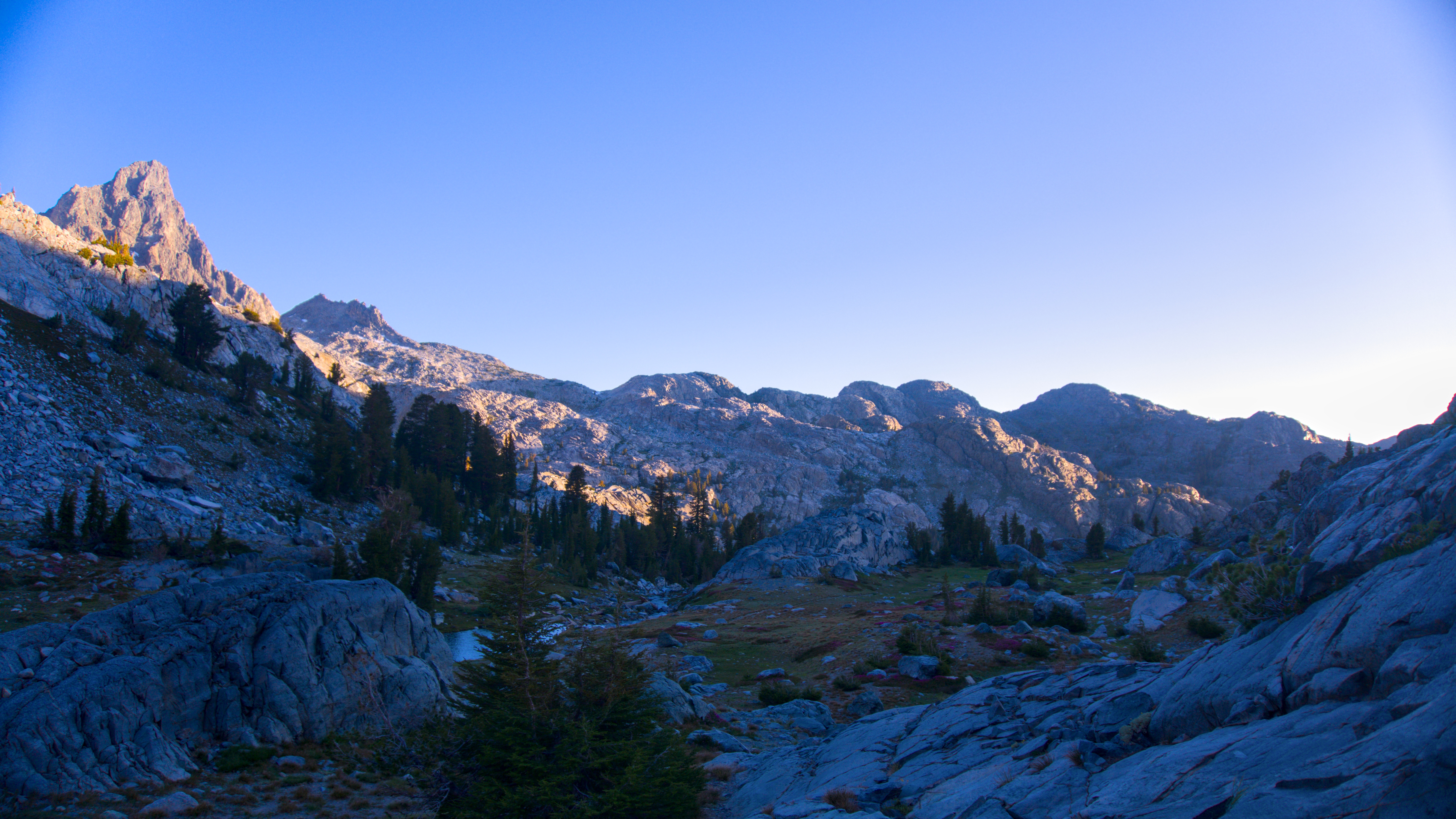
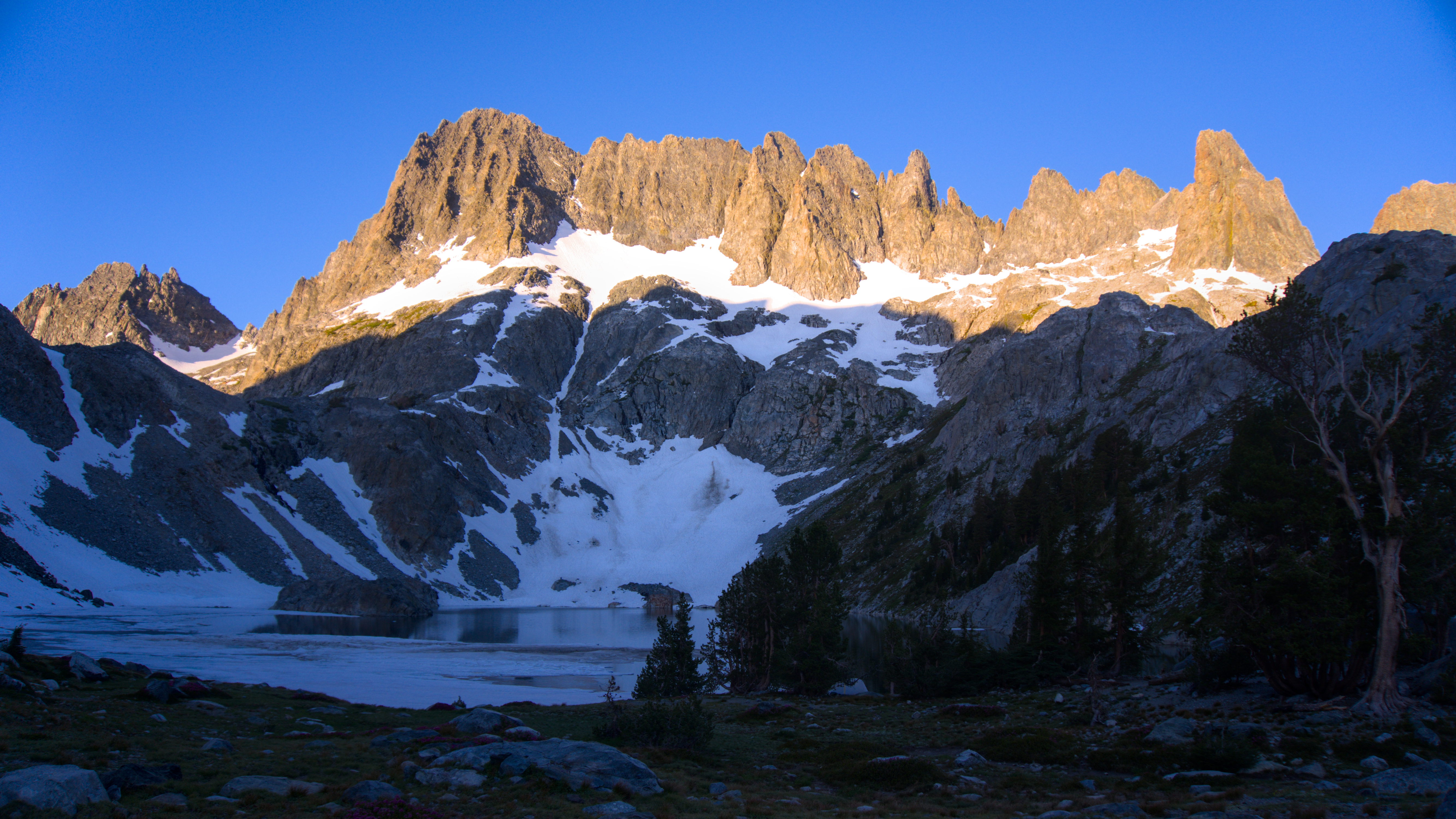 Sunrise on the Minarets
 The granite ridges above Ediza and Thousand Island Lakes
The next day I struck camp early as I could, said goodbye to the sunrise peaks above, and beat feet back to the river valley. The heat returned by 10am and I was dousing my bandana with lakewater to keep cool on the descent below Shadow Lake. The trail's initial gentle morning descent turns into a final, plodding climb in the baking afternoon sun, but I was glad to finally reach the trailhead. Newly arriving hikers advised me that the buses back to the resort were full, so I was told to hop on any bus that had an empty spot, whichever direction it headed. As I approached the stop, I heard the roar of diesel engines caught glimpse of it around the bend, so I had to end my 8 mile return hike with a fully-loaded 100 yard dash to catch the bus, an indignity I gladly suffered to arrive back in air-conditioned, standing room only accommodation.