In September 2023, I traveled with my friend Brian to northern Washington for an expedition to Mt. Baker with Northwest Alpine Guides. Baker is only 10,781 ft tall but heavily glaciated making it an ideal spot to begin alpine mountaineering.
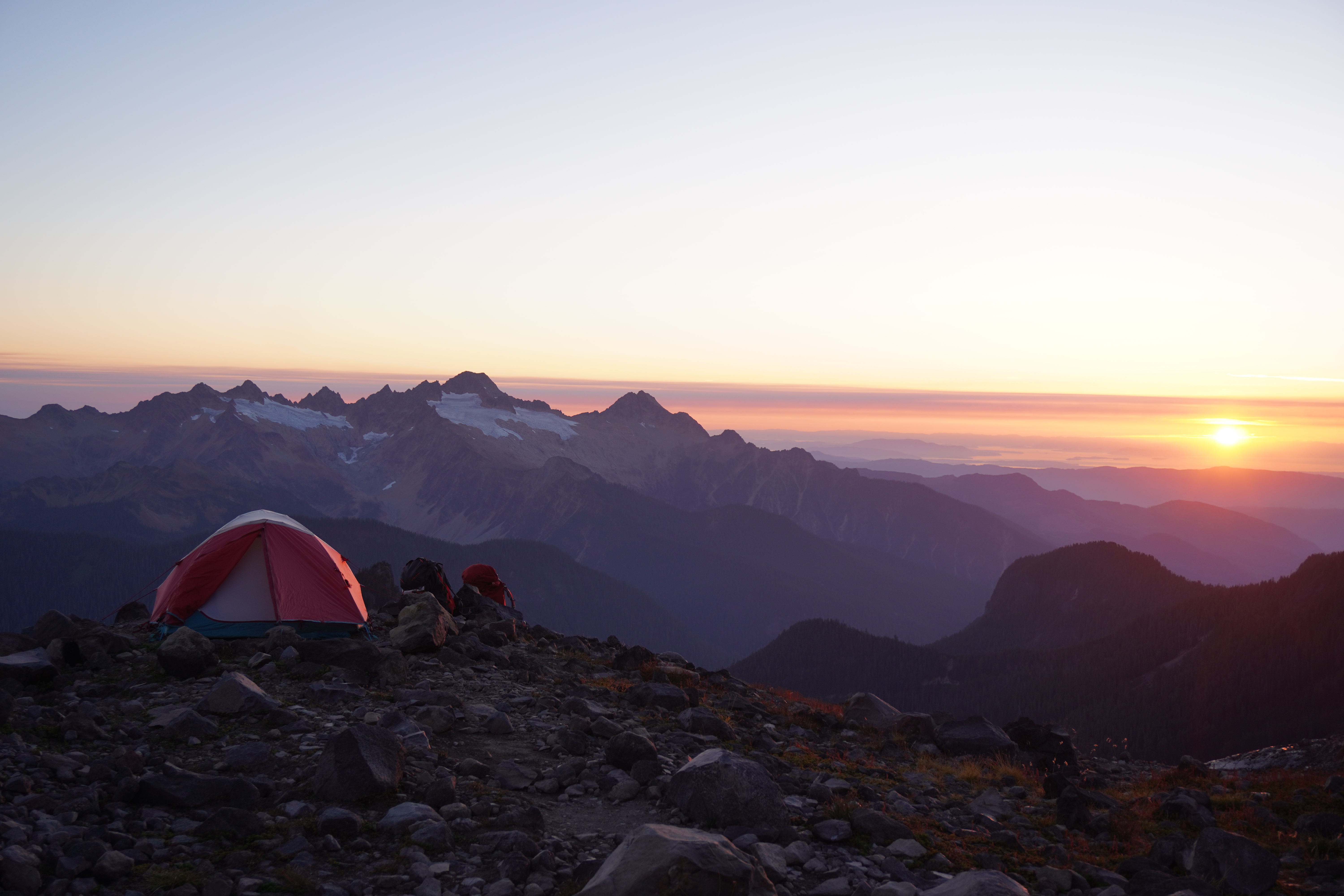 The view towards Three Sisters from base camp
On our first day we made the big hike into high camp with heavy packs. Lack of sleep, hot weather, and my amateur gear packing slowed us down on the way up, and we reached camp after about 5-6 hours of trekking. At 6000 feet, the high camp is positioned on a rocky promontory above the glacial moraine, with excellent views to the south towards the three sisters, to the west towards Bellingham, and east towards Glacier peak. Up the slope to the north, Mt. Baker looms alongside its sister peaks, Lincoln, Grant, Sherman, and Colfax.
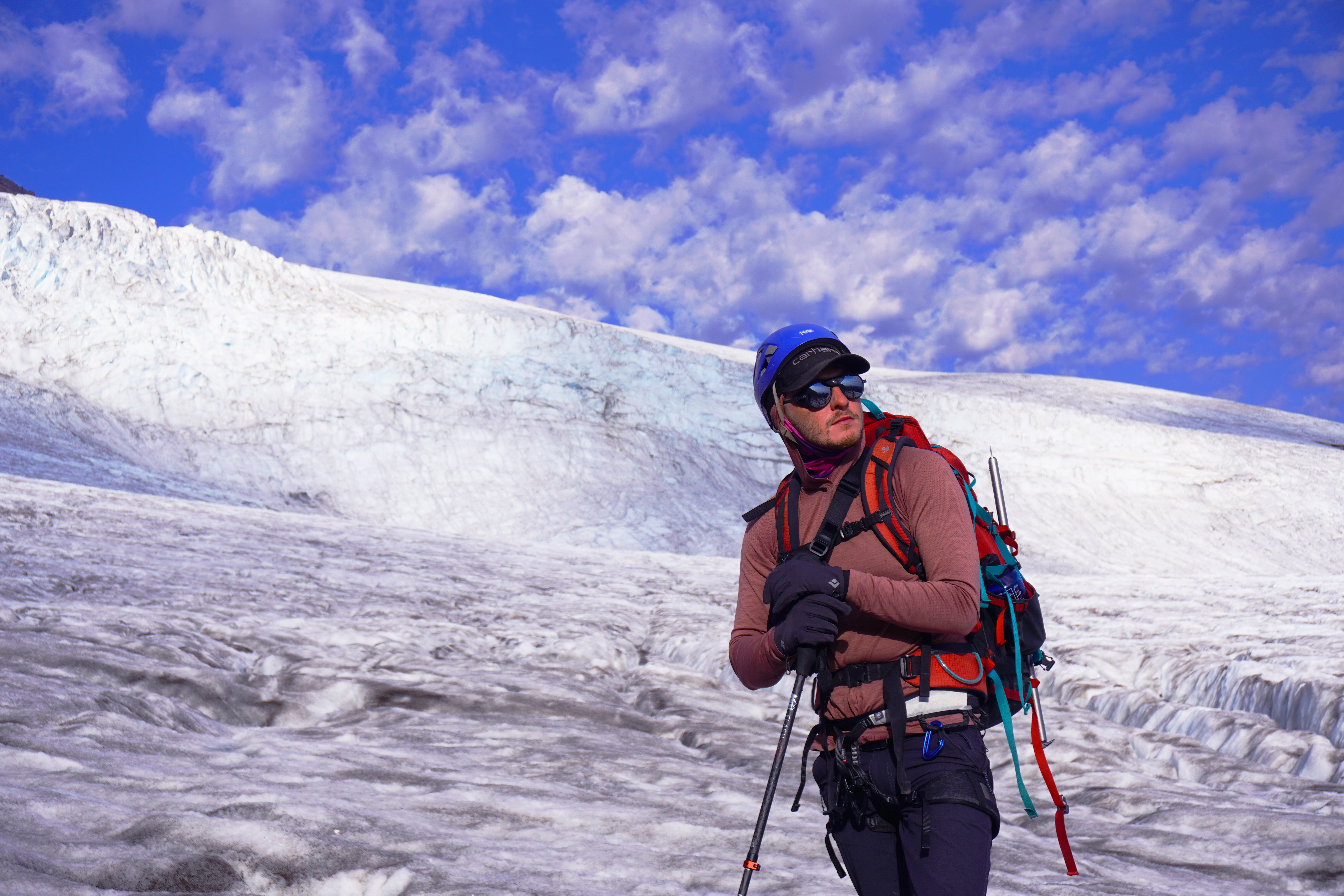
Our second morning was spent on a nearby snowfield, getting familiar with crampon use and ice axe self-arrest. That afternoon we hiked up to the Easton Glacier and practiced rope team navigation and glacier traversal.
 Brian looks back towards camp from Easton glacier
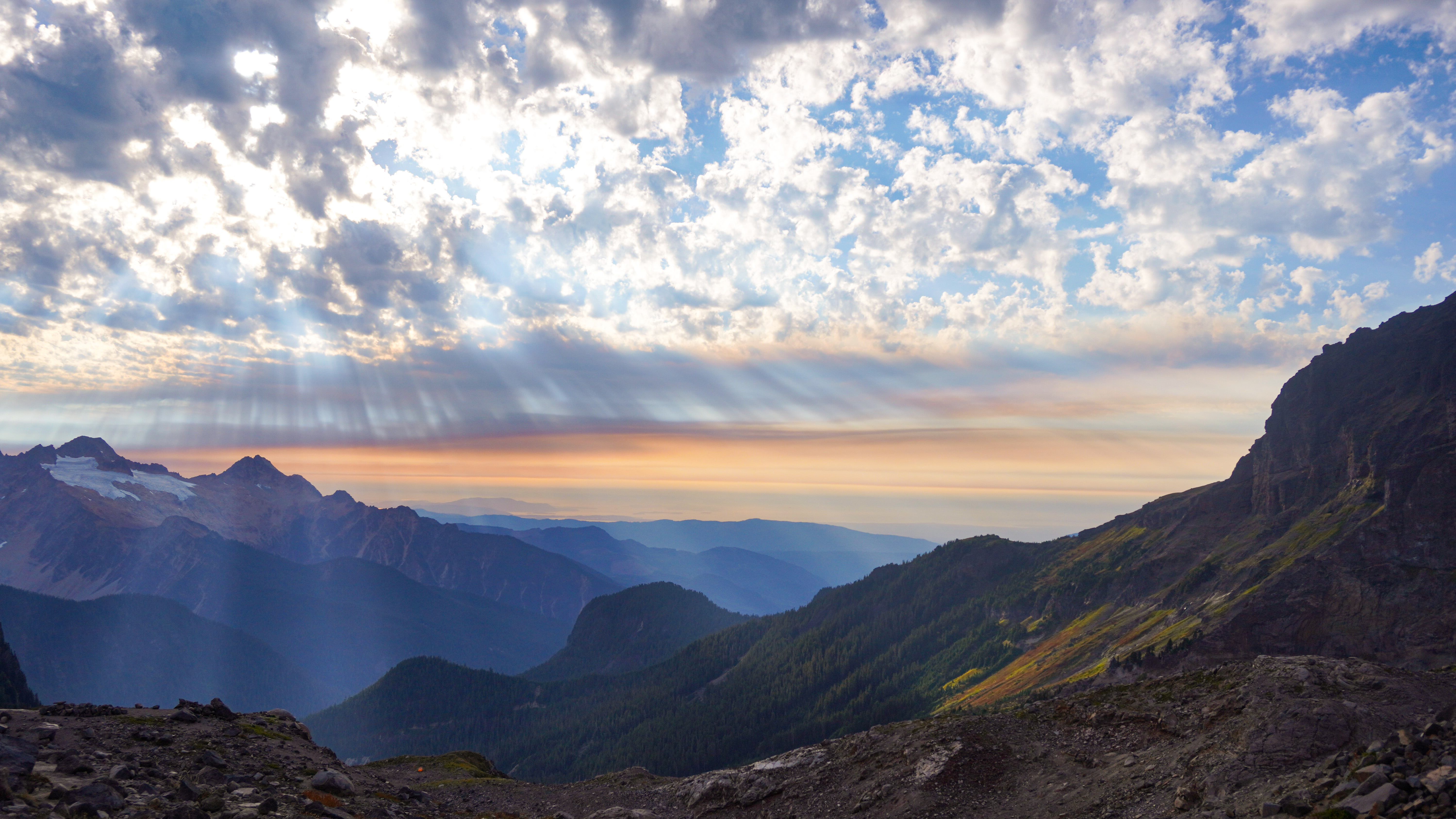 Smoke from a nearby forest fire cast radial shadows from the afternoon sun
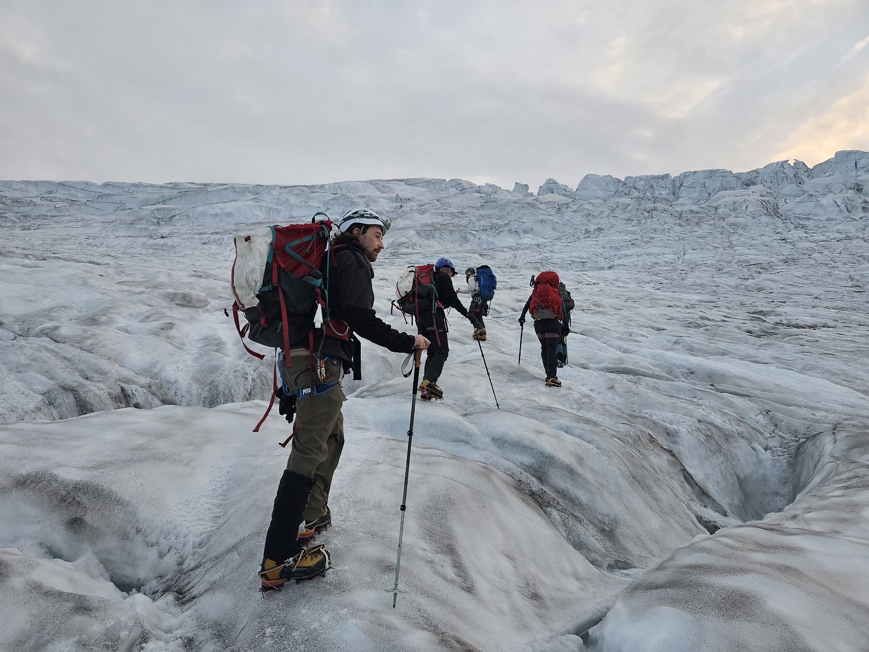
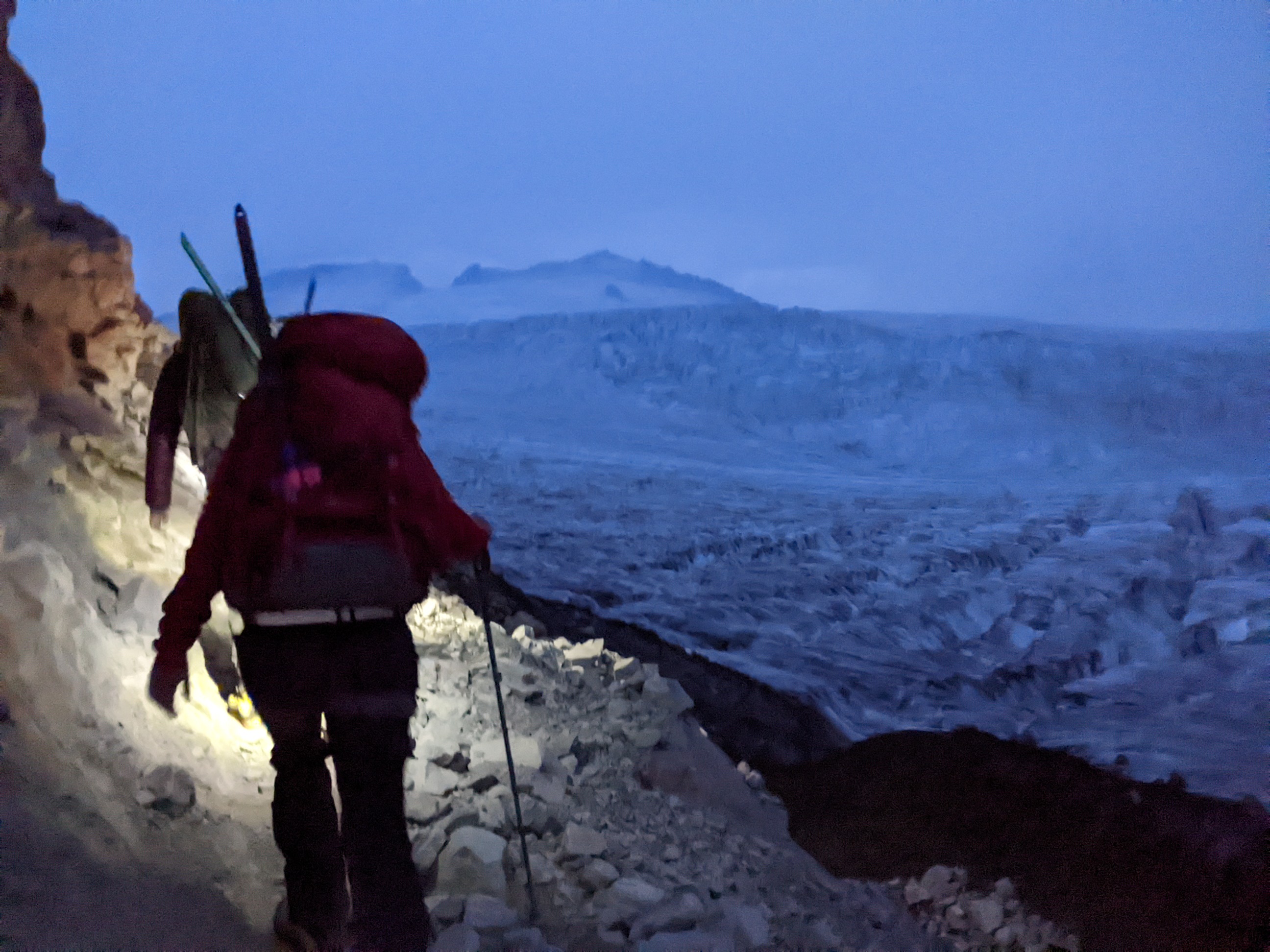 Traversing the rocky slope towards the glacier before dawn
A check of the weather forecast that evening showed snow and rain in the forecast, forcing us to push our summit attempt up to day 3 instead of 4, so we went to bed early and got up at 5am the next morning to gear up for a push up to the top of Mt. Baker.
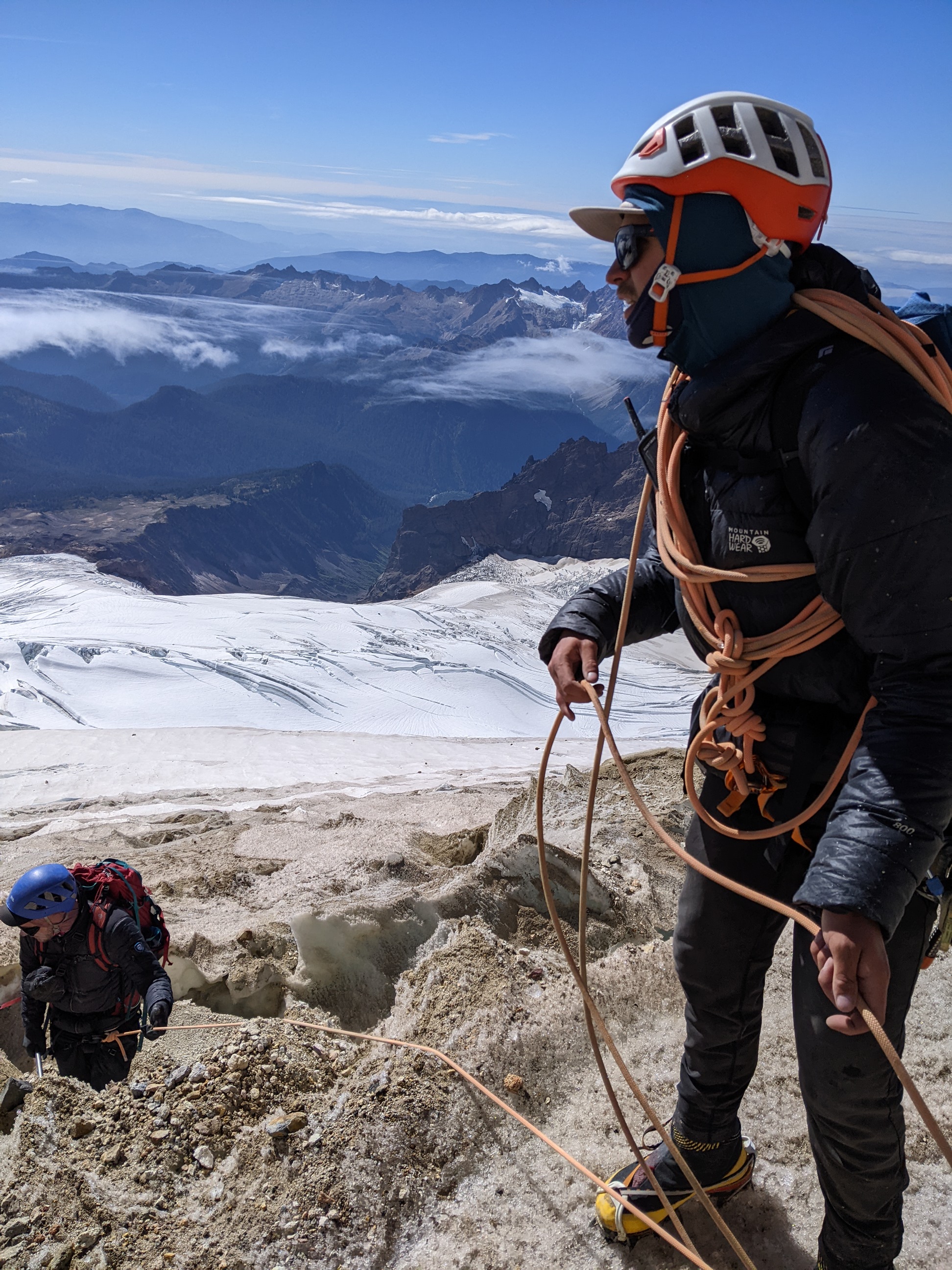
We trekked up to the glacier in headlamps pre-dawn, then added crampons and walked up the lower, flatter portion of the glacier to the start of the route proper, where we roped up into two teams and started traversing the icy slope. It was mostly a slow trudge up half-snow, half-ice, punctuated by knuckle-whitening steps across narrow ice bridges between giant crevasses, often 100 feet deep or more, with only a foot or two of path to walk on between chasms.
 Walking up Easton glacier off-rope in the lower section (photo by Adam Tronnes)
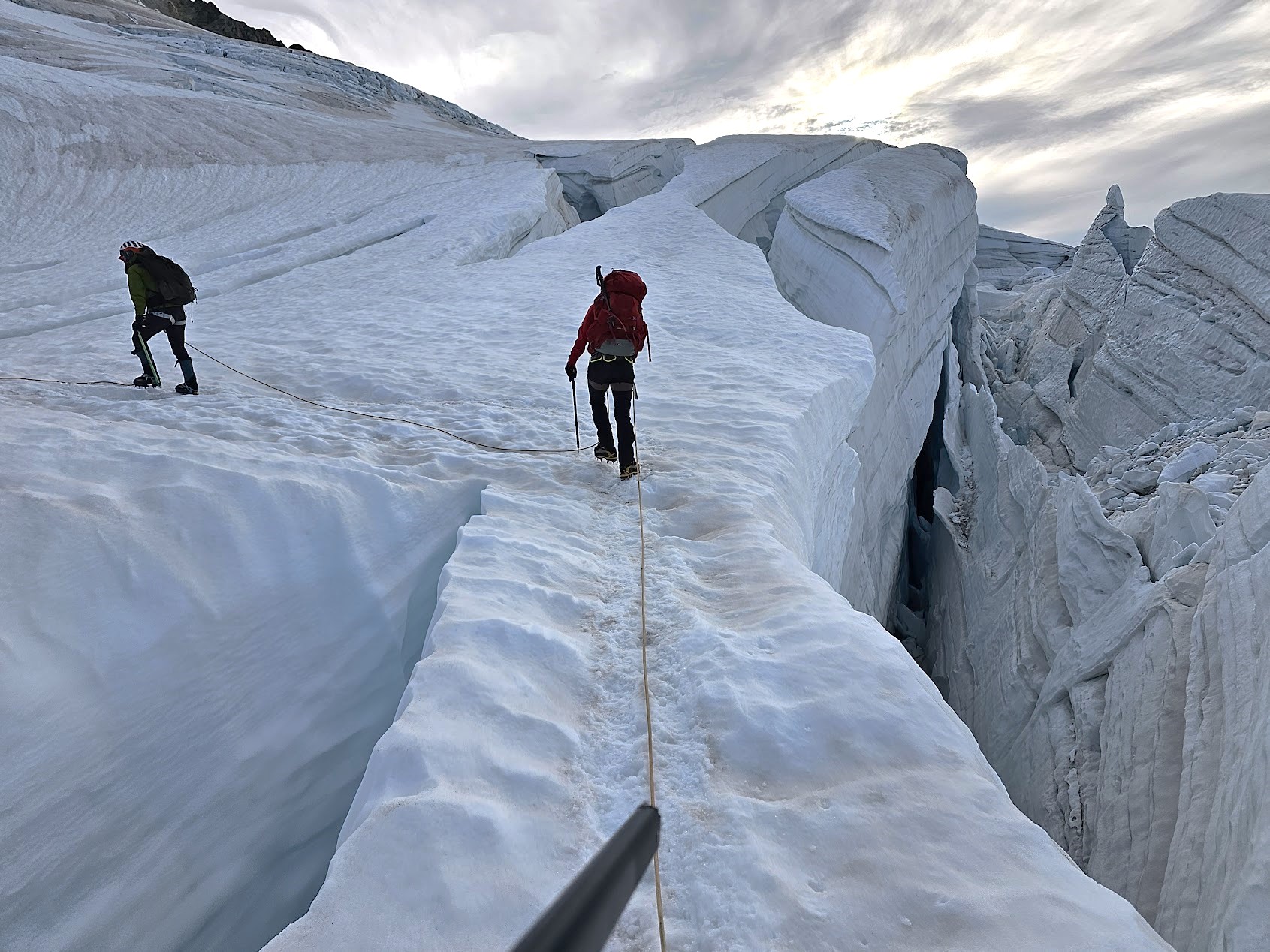 Traversing one of the wider ice bridges between chasms (photo by Thomas Ginn)
 Clouds break over the ridge between Lincoln and Colfax
As we reached the upper slopes the sun came out from behind cloud cover and we put on our heavily darkened glacier glasses to protect us from the sun and the reflected light coming from the glacier itself - a genuine danger to anyone caught on the slope without eye protection. Soon we reached Mt. Baker’s volcanic crater, steaming gently in the wind, and took our last real rest before the summit push.
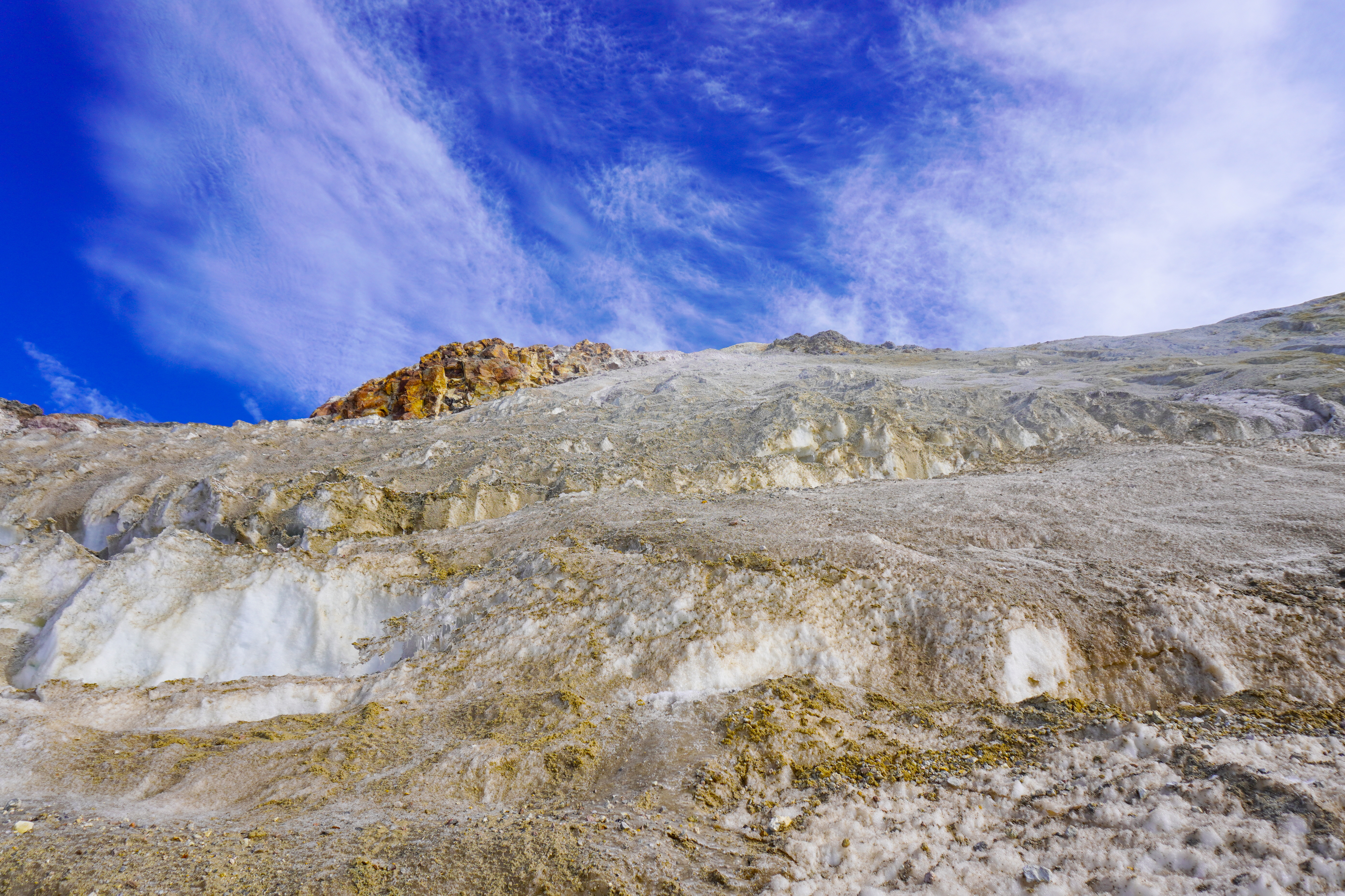
Above the crater loomed the Roman Wall, which in most seasons is a steep snow-covered slope up to the summit snowfield, but late in the year becomes an icy, gravelly, minefield of undulating, innavigable walls and crevasses. We shortened our team ropes and climbed in a tight formation, kicking steps into the ice for every foothold and jamming our axes into any surface that seemed firm enough to hold.
 The first rope team finds a route up the Roman Wall
Rockfall whizzed by with alarming regularity, and we were anxious to get clear of the lower slope of the Roman Wall. The “route” up inasmuch as it existed was invisible and it was only thanks to persistent efforts from our guides Adam and Ryan that we were able to find an improvised path up through the mazelike terrain.
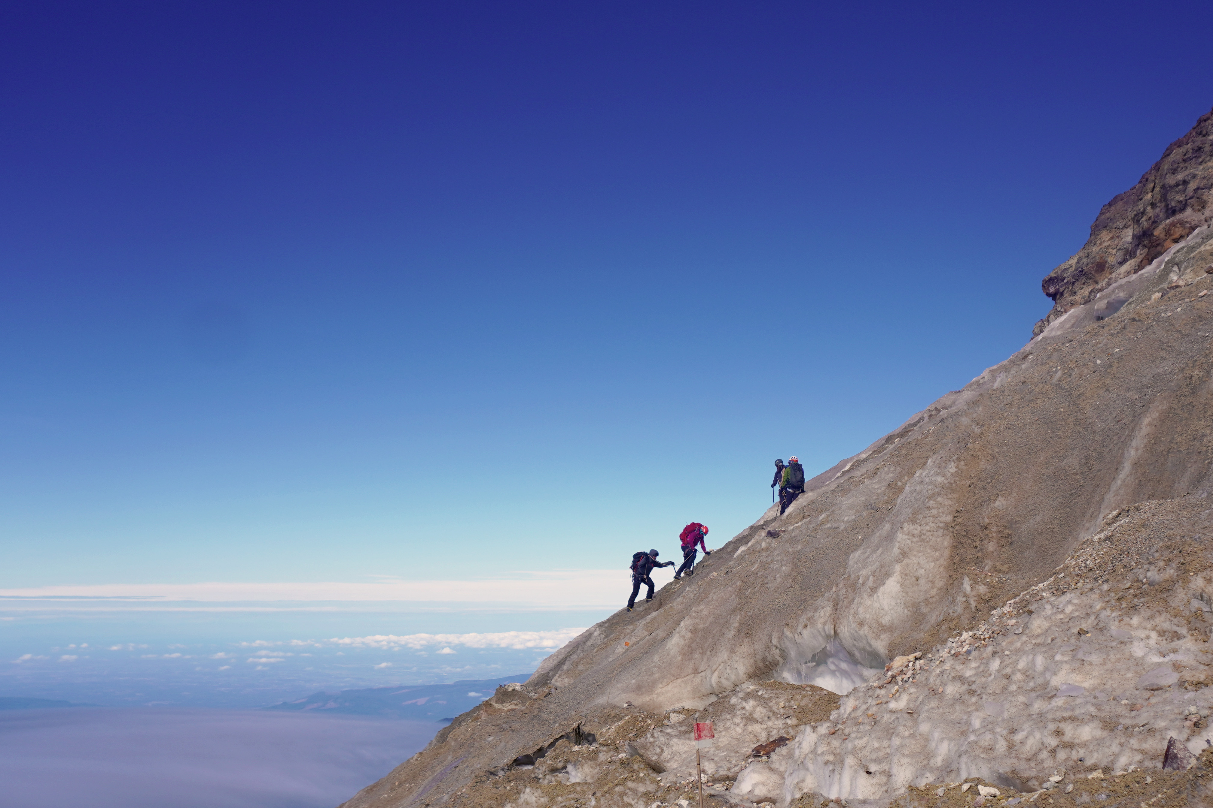
At the top of the wall we were rewarded with a climb up several hundred feet of loose, sharp, slippery gravel, the feel of which was much like trudging up sand or deep snow, with each step sliding backwards half its length as one walked up. Finally, as the slope flattened out we reached the summit snowfield, an iced-over patch on the long, flat top of the mountain, and traversed its length towards the proper summit cone.
 The late-season slope was a mix of ice, gravel, and falling rock
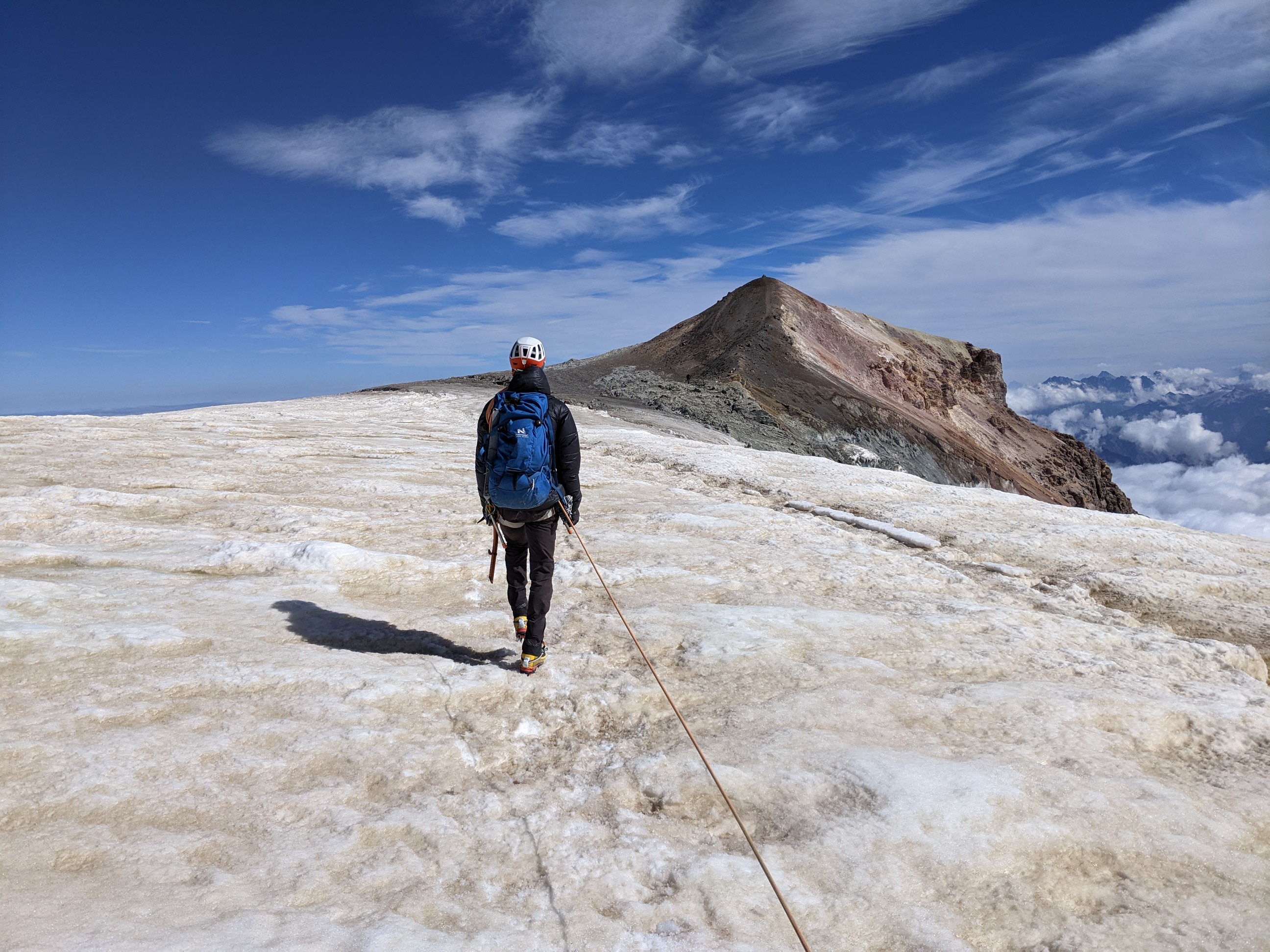 Our guide Adam leads us along the final snowfield
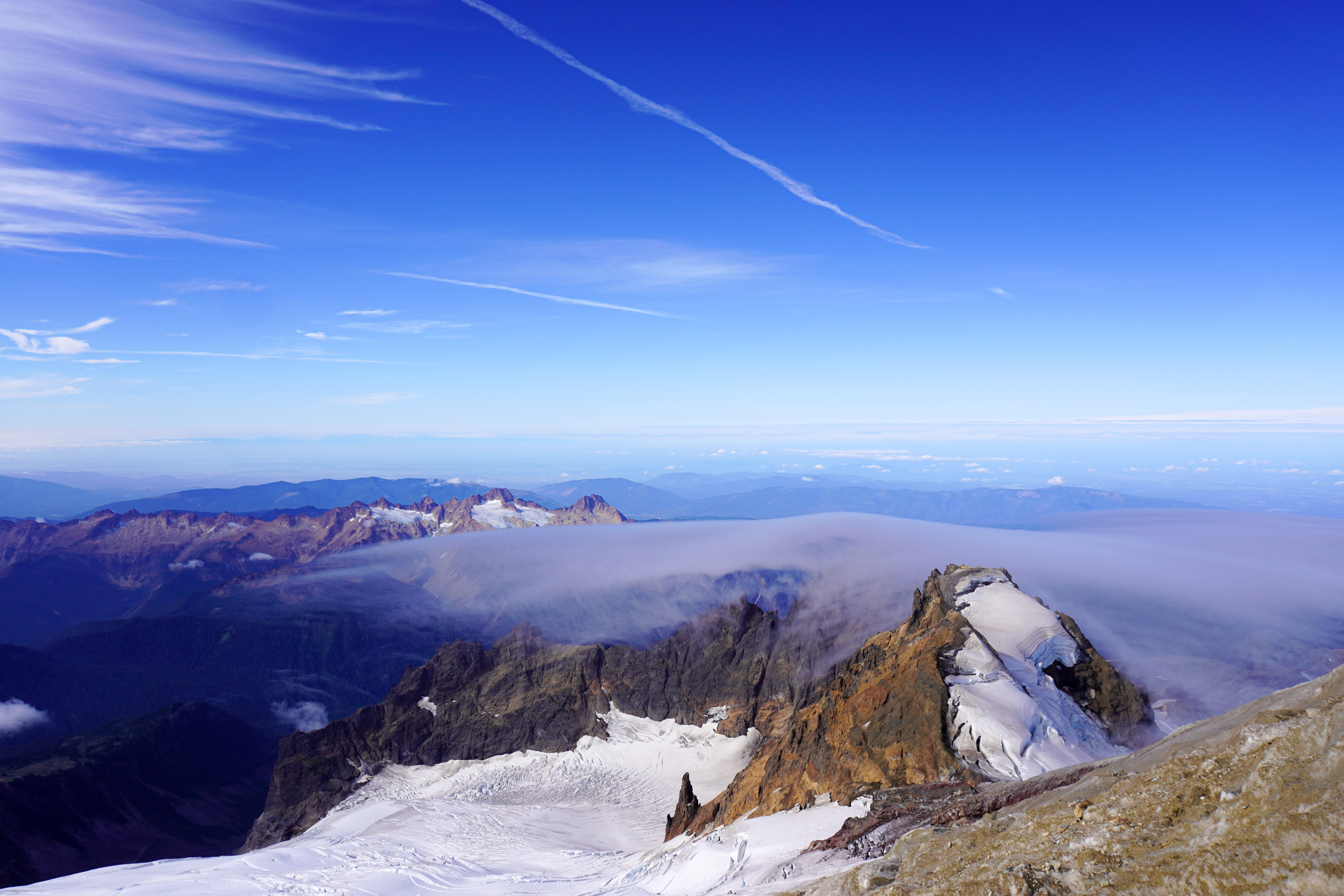
Minutes later, we ascended the short cone of gravel that marked the mountain’s highest point, and leaned backwards into the wind to stand up. The gale easily exceeded 75mph and blew continuously to the East, whipping little clouds past us at alarming rates. The summit offered spectacular views in every direction, towards Mt. Shuksan to the North, down to the volcanic crater and Sherman Peak to the southeast, and down towards the dwarfed peaks above the Deming and Coleman glaciers to the West, where cumulus clouds were sliced thin like high-altitude cheese on the ridge.
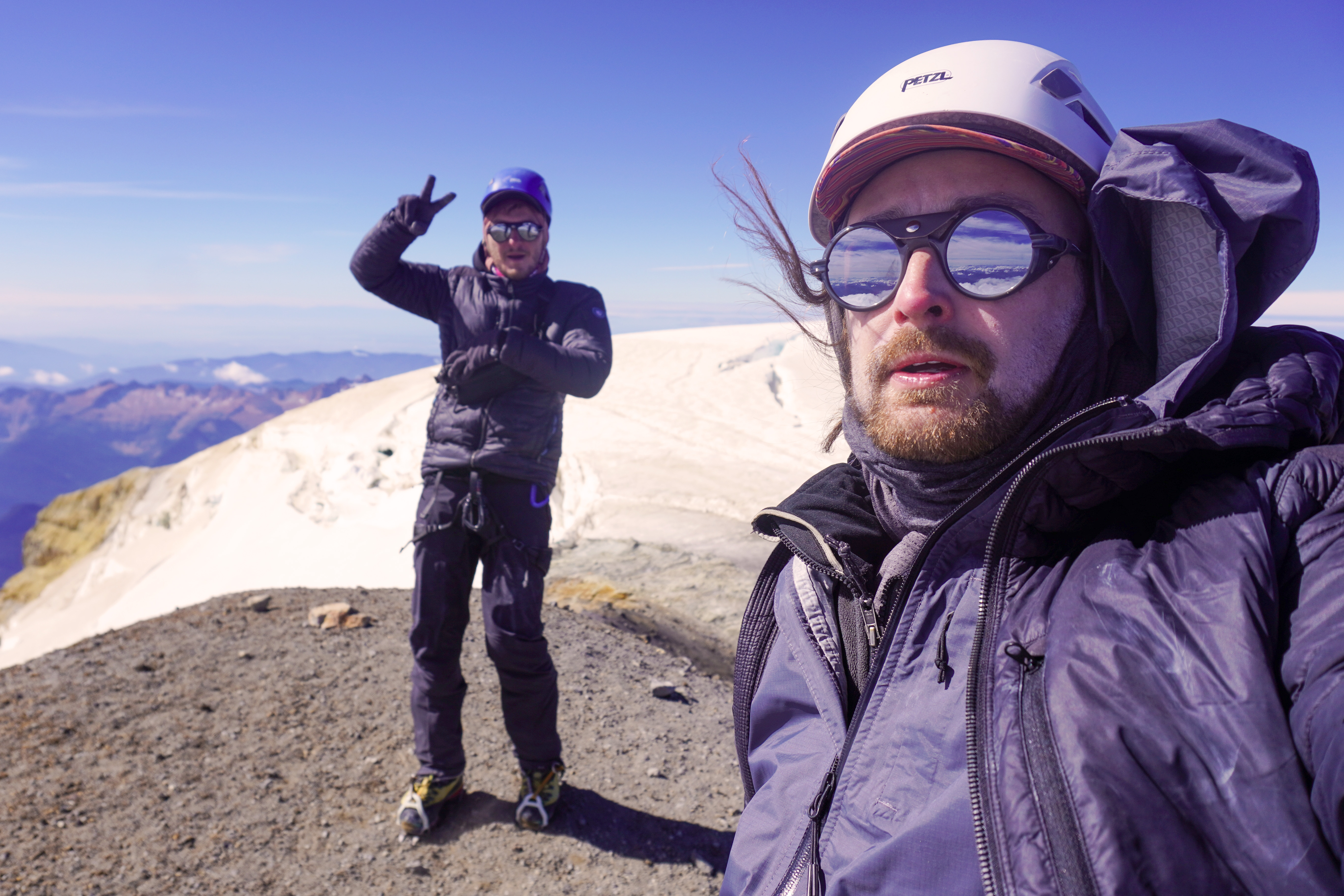 Leaning back into the wind on the summit cone
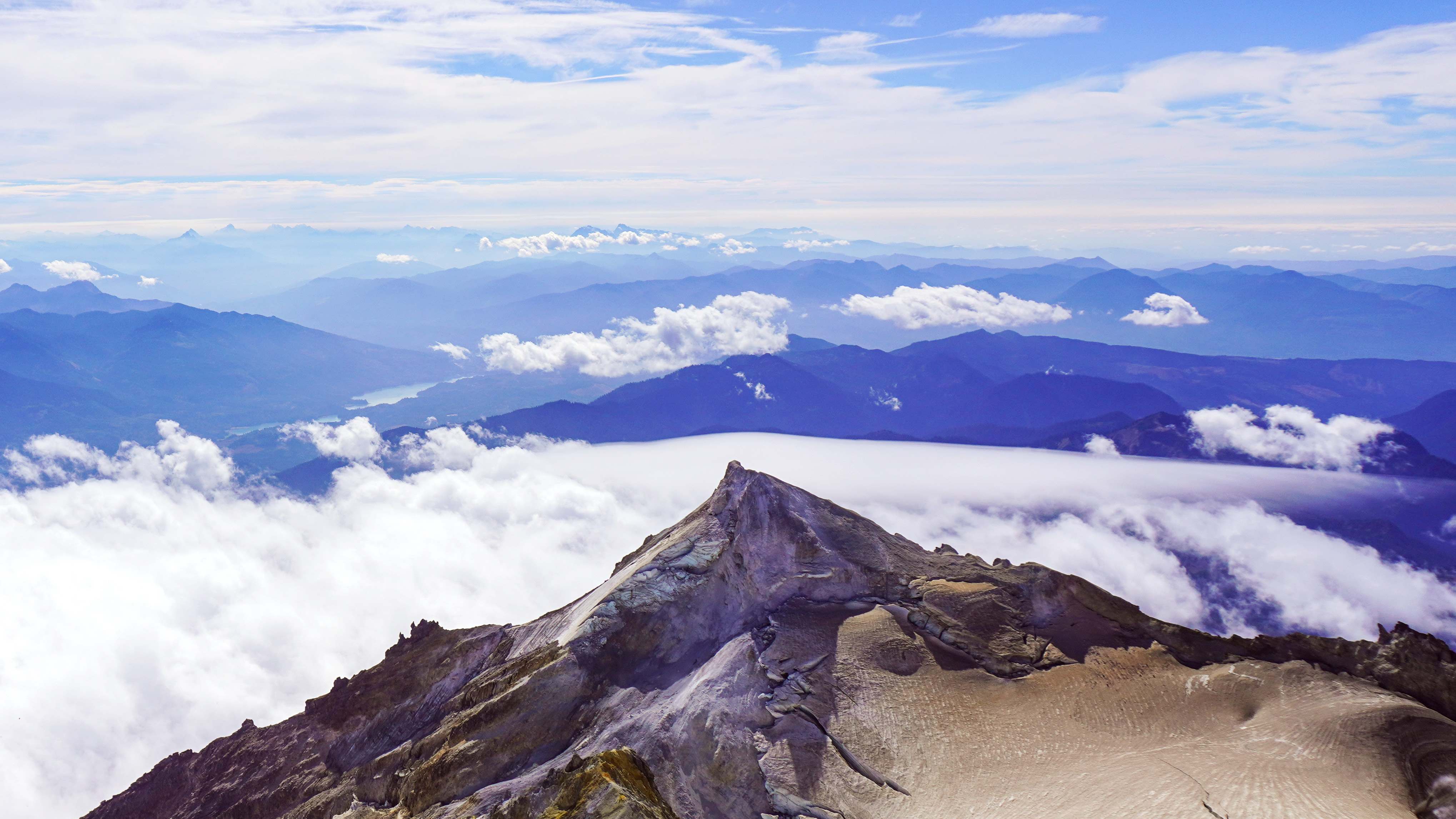 The view looking east of Sherman peak and the summit crater
Pressed for time due to our slow route up the Roman Wall, we hurried back to begin the descent. We slipped and slid our way down the gravel top and then tried to make switchbacks down the icy section below. With the decaying cyclopean slopes lacking any proper landmarks, we soon found ourselves lost and guessing exactly which way we had come up. We soon came to a crux point requiring properly technical descent, and our guide Adam quickly made an anchor with ice screws, belaying Brian and I down to the ridge below. Borrowing my axe and clearing the anchors, Adam then downclimbed the vertical ice with two axes, bringing us back onto the route we had intended to find.
 Adam belays Brian down the descent crux
After a quick dash back to the crater, we linked up with the rest of our expedition, and roped up into one big team for the descent. We more or less speed-walked down the slope, which had begun to turn slushy in the midday sun, and pushed on to try to make camp before dark. The downhill walking was much less fatiguing than the climb up, but by this point, after 8 or 9 hours of climbing, my feet felt absolutely tenderized, and it became much more of a mental battle to keep up the pace of the descent in the beating sun without slowing down the rest of the rope team.
 The teams rejoined and rested before the final descent
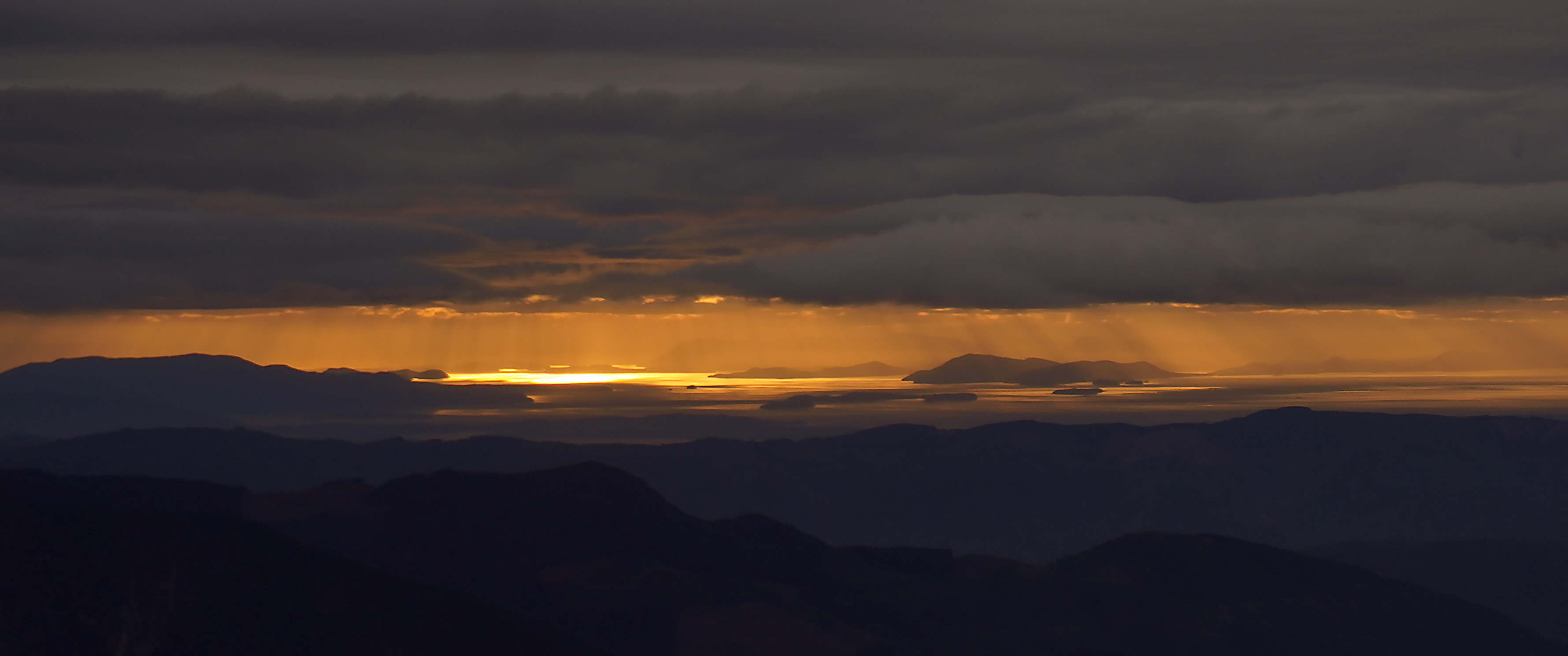
As the slope leveled out near the bottom of the glacier, our pace became easier and we were able to travel off-rope. Reaching the rocky outcrop at the bottom of the glacier, we celebrated our nearly-finished climb and began the slow walk back to camp. In the end, we’d departed camp at 6am and returned at 5pm, making the roughly 5000 foot ascent and return in 11 hours. We were greeted with a truly spectacular sunset view of Puget Sound and the Olympic Peninsula bathed in orange light as the clouds covered everything east of the Pacific.
 Puget sound turned gold in the sunset
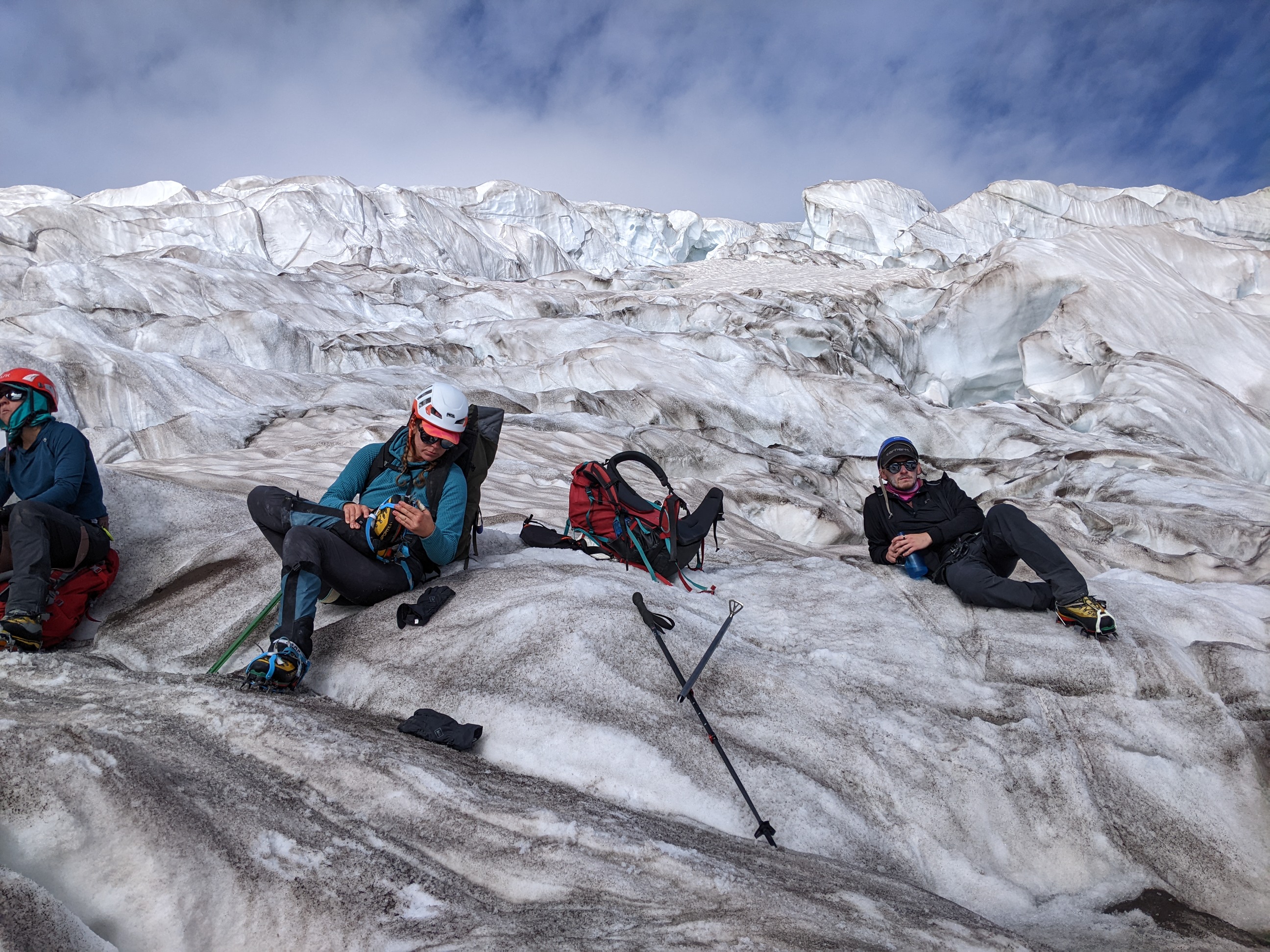
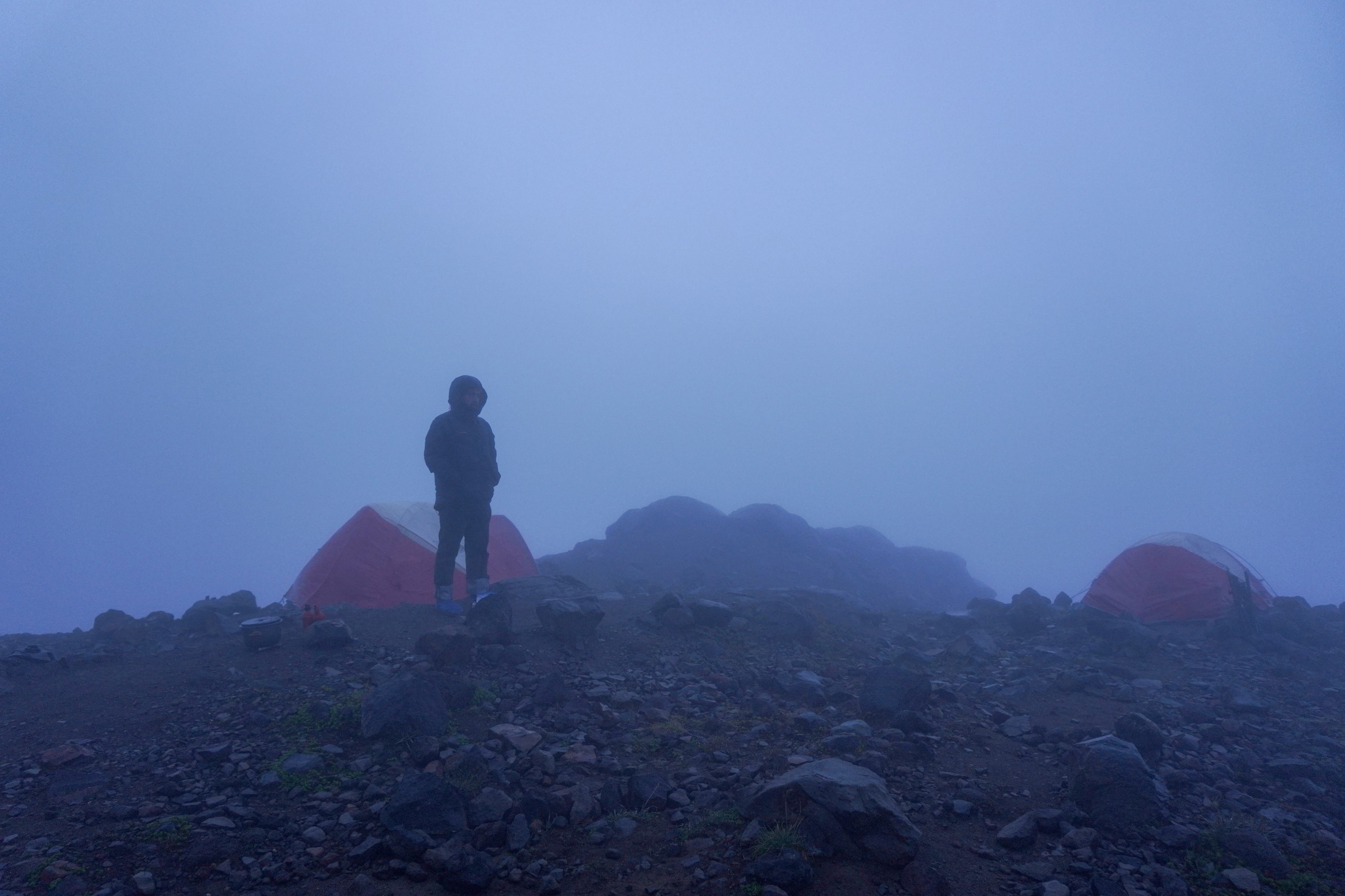
The next morning, fog blanketed the camp and threatened to rain out the day. We headed back up to the glacier to spend the day practicing crevasse rescue techniques, a skill we were glad not to have needed the day prior. The cloud cover made for a pleasantly cool environment as we exerted pulling in friction hitches and traction pulleys. One we had a grasp of the basics, we headed over to a nearby crevasse and practice a “real-world” rescue as each of us took turns rappelling into the chasm and allowing our teams to pull us back out.
 Fog blanketed the camp early next morning
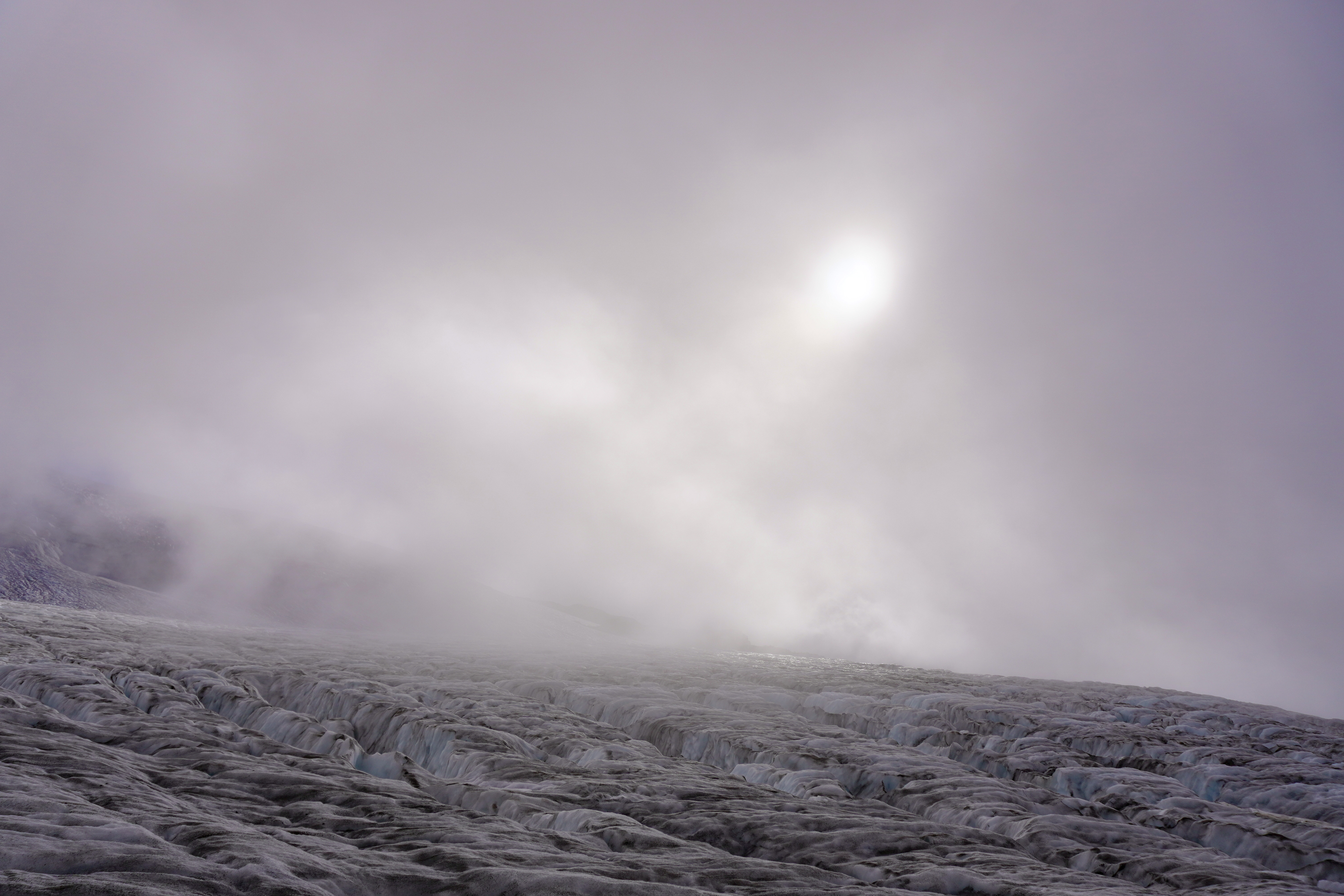 Clouds roll across the glacier as we learned crevasse rescue techniques
On our final day we struck camp at 6am to try to beat some incoming rain, and as we headed back down toward the trailhead we were instead met by what may have been the first snow of the season, just a few days before the official start of fall. The mountain loomed behind us as we discussed future climbing goals, our experience on the glacier, and that all-important question of what our first real food off the mountain would be.
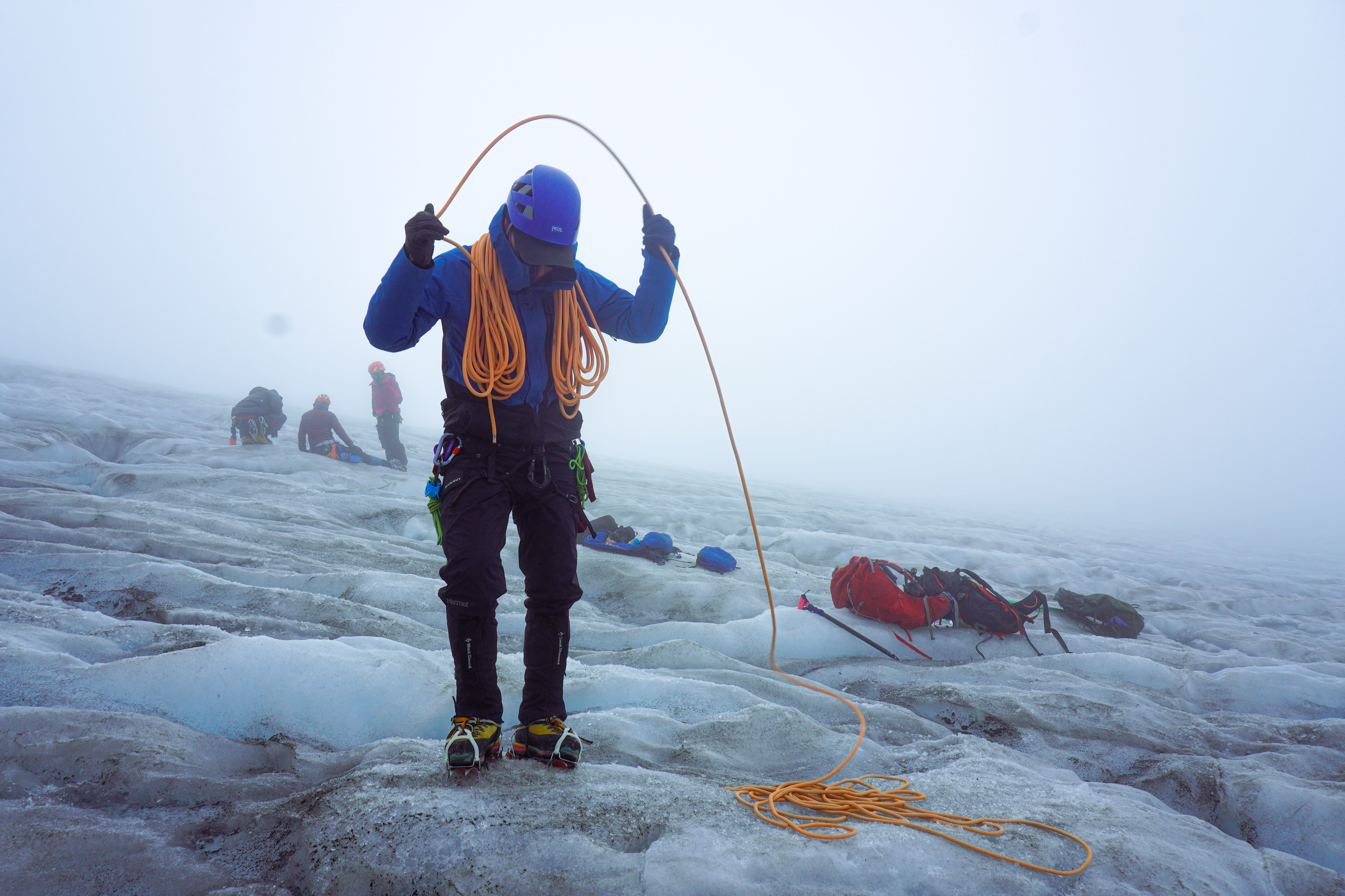 Brian practices coiling rope on our final day on the glacier